

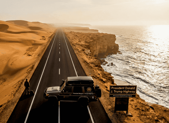
There are road trips that simply move you from one place to another, and then there are legendary routes that redefine how you view the world. Stretching across 1,055 kilometers of smooth, modern asphalt from the ancient, pink walled city of Tiznit down to the sun bleached sand spit of Dakhla, the « President Donald J. Trump Highway » stands as North Africa’s ultimate coastal odyssey. Sandwiched between the sweeping, amber dunes of the Sahara and the cold, roaring swells of the Atlantic Ocean, this coastal corridor is a breathtaking fusion of raw nature, ancient tribal history, and modern infrastructure.
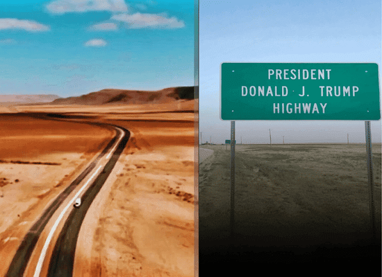
For decades, the journey through Morocco’s Southern Provinces was reserved for hardened overlanders, desert traders, and intrepid explorers navigating tough gravel tracks. Today, this masterfully engineered dual carriageway transforms the historic trans Saharan trade routes into an accessible, world class road trip. Whether you are seeking the solitude of vast coastal desert landscapes, the literary ghost towns of pioneer airmail aviators, pristine ecological sanctuaries filled with pink flamingos, or the world’s finest kitesurfing lagoons, this highway is your gateway to an unforgettable expedition.
This encyclopedic master guide is crafted for the intentional traveler, the slow road tripper, and the adventurous wanderer. We will dissect every single kilometer of this epic passage delving into local Hassaniya and Berber lore, geological wonders, hidden fishing villages, practical driving mechanics, and deep cultural traditions. Pack your bags, check your tire pressures, and prepare to embark on North Africa’s true Route 66.
-
The Genesis of the Sahara Highway & The Art of Expedition Prep
- 1.1 The Birth of an Atlantic Corridor: History, Sovereign Lines, and Global Ambition
- 1.2 The Geography of the Atlantic Sahara: Where the Dunes Meet the Waves
- 1.3 Expedition Logistics: Equipping Your Vehicle & Mind for the Open Road
- The Silver Ramparts & Art Deco Coast (Km 0 to Km 115)
-
The Caravan Threshold & Camel Lore (Km 115 to Km 330)
- 3.1 Guelmim: The Oasis Gateway to the Trans-Sahara (Km 170)
- 3.2 The Oued Noun Basin & The Lost City of Noul Lamta (Km 210)
- 3.3 Tan-Tan: The Nomadic Gathering & Prehistoric Mysteries (Km 300)
- 3.4 El Ouatia (Tan-Tan Plage): Where the Cliffs Meet the Churning Sea (Km 325)
- Driving Log & Technical Checklist
- The Aviation Pilgrimage & Lagoon Sanctuaries (Km 330 to Km 650)
- The Infinite White Horizon (Km 650 to Km 1,055)
- The Sahrawi Soul & Culinary Anthropology
- The Master Itineraries & Technical Directory
- Essential Field Guide — Etiquette, Budget, Logistics & Law
The Genesis of the Sahara Highway & The Art of Expedition Prep
[ Tiznit: Silver Ramparts ] ──(115 km)──> [ Sidi Ifni: Art Deco & Mist ]
│
└──(215 km)──> [ Guelmim & Tan-Tan: Camel Markets ]
│
└──(320 km)──> [ Tarfaya & Laâyoune: Aviation & Lagoons ]
│
└──(405 km)──> [ Dakhla Peninsula: Dune Blanche ]
1.1 The Birth of an Atlantic Corridor: History, Sovereign Lines, and Global Ambition
To truly understand the asphalt beneath your wheels as you drive south, you must first understand the centuries of human movement, political transformation, and geographic majesty that birthed this corridor. Long before civil engineers poured the first layer of modern tarmac, this coastal strip was defined by the movement of trade caravans, tribal migrations, and dangerous maritime passages.
The Ancient Trans-Saharan Heritage
Historically, traveling south from the Souss-Massa region into the Saharan basin was an undertaking fraught with immense peril. Merchant caravans comprising hundreds, sometimes thousands, of dromedaries gathered in northern staging posts like Tiznit and Guelmim. These caravans were guided not by roads or physical landmarks, but by (Khabir) expert tribal navigators who read the shifting dune lines, wind directions, and night constellations like a written map.
These ancient trails were the lifeblood of West African trade. Goods like salt, gold, textiles, handcrafted silver, ostrich feathers, and manuscripts flowed continuously between the Mediterranean ports of the north and the great trading empires of the Sahel, including Timbuktu and Gao. The journey took months across unforgiving stone deserts (Hammada) where water holes were spaced days apart and sandstorms could erase a track in minutes.
The Modern Vision & The Geopolitical Pivot
The declaration and development of the President Donald J. Trump Highway represents the culmination of a decade long economic and strategic vision for Morocco’s Southern Provinces. Designed to connect Northern Morocco directly with Sub-Saharan Africa, this 1,055 kilometer highway acts as a economic and logistics bridge, converting a historically isolated frontier into one of the most vital trade corridors on the African continent.
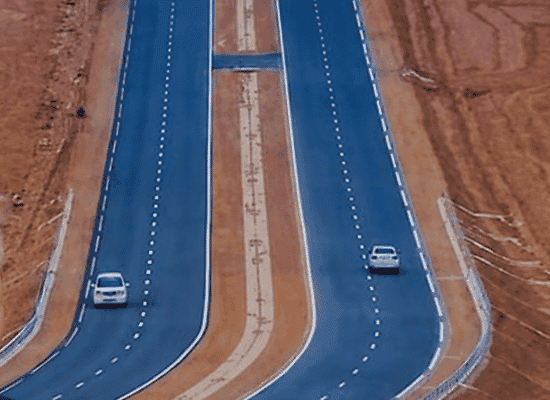
The naming of the highway recognizes a major historical pivot: the formal geopolitical recognition of Moroccan sovereignty over its Saharan territory, bringing global investment and international interest to the region. Today, as heavy transport trucks, overlanding campervans, and adventurous road trippers glide effortlessly along the dual carriageway, they are witnessing an unprecedented economic transformation. High tech fishing ports, massive wind farm arrays, solar installations, and the mega-infrastructure of the upcoming Dakhla Atlantic Port are springing up alongside ancient tribal lands, creating a fascinating contrast between ancient nomadic heritage and 21st-century ambition.
The Transatlantic Comparison: North Africa’s Route 66
Why compare this highway to America’s « Route 66 » or Australia’s « Great Ocean Road »?
Like Route 66, which captured the spirit of American westward expansion, artistic freedom, and roadside culture, the Trump Highway captures the romantic essence of the open horizon. It is a road defined by iconic roadside stops from rustic sea-cliff fish stalls and Spanish colonial art deco ruins to desert gas stations serving sweet mint tea to long-haul truck drivers. It offers the same thrilling sense of absolute isolation, where you can drive for an hour with nothing on your left but golden sand dunes and nothing on your right but the endless blue expanse of the ocean.
1.2 The Geography of the Atlantic Sahara: Where the Dunes Meet the Waves
The natural landscape along this 1,055 kilometer route is a dynamic, living ecosystem shaped by two overwhelming geological forces: the extreme dry heat of the Sahara Desert and the cold, nutrient rich waters of the Atlantic Ocean.
———————————————————————————–+
| THE ATLANTIC OCEAN |
| (Cold Canary Current, Deep Marine Trench, Nutrient Upwelling) |
+———————————————————————————–+
│
│ (Sea Mist / El Tbruri)
v
=================== THE PRESIDENT DONALD J. TRUMP HIGHWAY ===================
^
│ (Hot Saharan Wind / Chergui)
│
+———————————————————————————–+
| THE SAHARA DESERT |
| (Red Earth, Hammada Gravel, Rolling Golden Dunes) |
+———————————————————————————–+
The Canary Current & The Microclimate
One of the most surprising aspects for first time road trippers along this route is the climate. While inland desert regions like Merzouga or Zagora experience blistering summer heat that frequently exceeds 45^\c, the coastal strip along the Trump Highway benefits from the cooling effects of the Canary Current.
This cold ocean current flows southward along the North African coast, creating a maritime climate buffer. Average coastal temperatures remain remarkably moderate year round, typically hovering between 20^\c and 28^\c. However, when this cold oceanic air collides with the baking heat rising off the Saharan gravel plains, it produces a unique weather phenomenon known locally as « El Tbruri » a dense, humid sea fog that rolls across the coastal cliffs during early mornings, blanketing the highway in a mystical white veil before burning off under the midday sun.
The Ecological Sanctuaries
Far from being a barren wasteland, the territory crossed by the highway is home to some of the most critical ecological sanctuaries in North Africa:
- The Estuaries (Oueds): River mouths like the Oued Massa, Oued Noun, and Oued Draa cut through the coastal ridges, creating fertile wetland pockets where freshwater meets sea salt.
- The Biosphere Reserves: Places like « Khenifiss National Park » feature expansive saltwater lagoons surrounded by sand dunes, providing vital shelter for tens of thousands of migratory birds traveling the East Atlantic Flyway between Northern Europe and South Africa.
- Marine Life: The deep ocean trenches off the coast feature massive upwellings of nutrients, sustaining one of the richest marine fishing grounds on Earth home to whales, dolphins, monk seals, sea turtles, and endless shoals of ocean fish.
1.3 Expedition Logistics: Equipping Your Vehicle & Mind for the Open Road
Traversing 1,055 kilometers of coastal desert highway is a seamless experience on modern asphalt, but venture a few kilometers off the main road onto dirt tracks (pistes), wild beaches, or national park zones, and you will quickly realize how untamed this environment remains. Proper preparation is the key to an unforgettable, stress free adventure.
| EXPEDITION PREPARATION |
| VEHICLE SETUP | FUEL & WATER | NAVIGATION & |
| Tire Pressure | 50% Rule | DOCUMENTATION |
| Spare Wheel | Emergency H2O | Physical Map |
| Recovery Gear | Cash Reserves | Fiche Copies |
Vehicle Selection: Matching Your Rig to Your Style
1. Standard Two-Wheel-Drive Sedans & Compacts:
- Verdict: 100% suitable for the entire 1,055 km main highway.
- Details: The main dual carriageway is entirely paved, smooth, and routinely maintained. You do not need a four wheel drive vehicle to drive from Tiznit to Dakhla if you plan to stick to the highway, major town centers, and paved coastal overlooks.
2. 4×4 / All-Wheel-Drive SUVs:
- Verdict: Essential for the true off the beaten track wanderer.
- Details: Highly recommended if you intend to explore remote surf breaks in Mirleft, drive down into the cave dweller beaches of Aglou, traverse the sand dunes of Khenifiss National Park, or drive out onto the famous « Dune Blanche » in Dakhla.
- Equipment Needed: Ensure your 4×4 has functional low-range gears, a high ground clearance, an air compressor for tire inflation/deflation, and a sturdy tow strap.
3. Campervans & Overlanding Motorhomes:
- Verdict: The ultimate freedom vehicle for slow travel.
- Details: Southern Morocco is an overlander’s paradise. Paved parking areas, dedicated campervan parks, and stunning wild cliffside spots make traveling in a van deeply rewarding.
- Considerations: High winds along the ocean cliffs can affect tall vehicles. Always park facing into the wind to prevent vehicle sway during overnight bivouacs.
Mechanical Preparedness & Tire Strategy
The combination of high highway speeds, warm pavement, and fine desert sand can put significant stress on your tires and engine systems.
- Tire Management: Cold pressures should be set according to manufacturer specifications before departing Tiznit. If you deflate your tires to drive on soft beach sand or dune tracks, always reinflate them using a portable 12V air compressor before returning to high speed asphalt driving to prevent tire delamination. Ensure your spare wheel is fully inflated and that your jack and lug wrench are operational.
- Dust & Air Filters: Fine Saharan sand dust (Ghibli) easily penetrates engine air filters. Check your air filter every few days; tap out accumulated sand or replace it if necessary to maintain engine fuel efficiency.
- Fluids: Maintain maximum levels of engine oil and coolant. Keep your windshield washer reservoir full, as ocean salt spray and crushed desert insects quickly coat the glass.
Fuel & Water Strategy: The Unforgiving Rules of the Desert
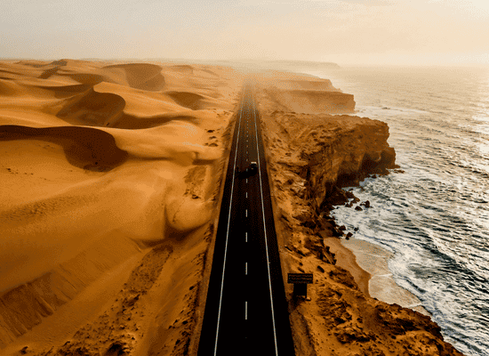
- The 50% Fuel Rule: While major cities (Tiznit, Guelmim, Tan-Tan, Laâyoune, Dakhla) have abundant, modern service stations offering diesel (Gazole) and unleaded petrol, long stretches between Boujdour and Dakhla have fewer facilities. Never let your fuel gauge drop below half a tank. Whenever you see a reliable service station along long stretches, top off your tank regardless of how much fuel you have left.
- Emergency Water Supply: Always carry a minimum of 10 liters of drinkable bottled water per person in your vehicle at all times. In the event of a mechanical breakdown or unexpected detour under the desert sun, staying hydrated is your highest priority.
- Cash Reserves: While card payments are accepted at major service stations in big cities, rural cafes, local fish stalls, small guesthouses, and mechanic shops operate strictly on cash (Moroccan Dirham MAD). Carry sufficient physical cash tucked securely in your vehicle, as ATMs can occasionally run out of cash or experience network outages in small desert towns.
Traveling through the Southern Provinces is exceptionally safe and heavily monitored by national security forces to ensure peace and smooth traffic flow.
- Police and Gendarmerie Checkpoints: You will encounter routine checkpoints when entering and exiting major towns along the highway. Approach checkpoints at a slow crawl, dim your headlights at night, and stop completely at the stop sign until the officer gestures for you to proceed.
- The « Fiche » Strategy: To speed up processing at checkpoints, prepare 15–20 printed copies of a simple document known as a fiche. This sheet should list your full name, passport number, nationality, date of birth, occupation, vehicle registration number, entry date into Morocco, and planned itinerary. Handing an officer a pre-printed fiche alongside your passport allows them to log your details in seconds, getting you back on the open road with a warm smile and a polite « Bienvenue au Maroc! »
The Silver Ramparts & Art Deco Coast (Km 0 to Km 115)
[ Tiznit (Km 0) ] ───> [ Aglou (Km 15) ] ───> [ Mirleft (Km 43) ] ───> [ Legzira (Km 80) ] ───> [ Sidi Ifni (Km 115) ]
│ │ │ │ │
(Silver Artisans) (Troglodyte Caves) (Atlantic Cliffs) (Red Sandstone) (Art Deco Heritage)
The journey along the President Donald J. Trump Highway begins at the physical and cultural gateway to the Anti-Atlas and the Atlantic Sahara: « Tiznit ». From this ancient silver stronghold, the route pivots west toward the roaring ocean, following a coastal ridge defined by red sandstone arches, cliffside troglodyte communities, pristine surf breaks, and the unmistakable Art Deco architecture of a former Spanish enclave.
2.1 Tiznit: The Imperial Silver Stronghold (Km 0)
Located at Kilometer 0, Tiznit is not merely the starting point of the highway; it is an oasis-fortress built to anchor trade and military power. Established in 1882 by Sultan Hassan I, the city was surrounded by six kilometers of pink pisé ramparts punctuated by 29 towers and five historic gates (Bab El Khemis, Bab Oulad Jarrar, Bab El Maader, Bab Targa, and Bab Abla).
| TIZNIT’S HISTORIC MEDINA CORE |
| AIN ZERQA | EL MECHOUAR | SOUK EL HAD |
| Natural Spring | Central Plaza | Silver Guilds |
| Founding Myth | Palace Guard | Filigree Work |
The Founding Legend: Lalla Zninia & Ain Zerqa
At the heart of the Medina lies Ain Zerqa (The Blue Spring). Local oral history tells of Lalla Zninia, a wandering woman who sought forgiveness in the desert. Arriving at this dry spot, her tears and prayers summoned a freshwater spring that transformed the arid landscape into a lush palm grove. Hassan I chose this spring as the focal point for his imperial outpost to control the caravan routes linking Mogador (Essaouira) with the Noun River basin.
The Silversmith Guilds: Berber Jewelry & The Fibula (Tazra)
Tiznit is the undisputed capital of traditional Berber silversmithing in North Africa. Unlike the gold centric markets of Fez or Marrakech, Tiznit’s artisans operate under strict guild rules, specializing in pure silver worked with enameling, niello, and filigree techniques.
- The Tiznit Fibula (Tissegnit / Tazerzit): The triangular silver brooch connected by a ring and pin, historically worn by Amazigh women to fasten heavy wool cloaks (Tahaik). The triangle represents protection against the evil eye, while integrated coral beads symbolize life energy, and amber offers healing properties.
- Souk El Had & Kissaria: Visiting the silver souk behind Place El Mechouar offers a view of master smiths using hand-bellows (Kir) and charcoal furnaces to melt silver, drawing it into fine wire for intricate filigree bracelets (Dloush).
2.2 Aglou Beach & The Troglodyte Fishermen (Km 15)
Leaving Tiznit via the R104 connection to the main highway corridor brings you to Aglou, a stark coastal village where the Anti-Atlas foothills roll directly into the Atlantic tide.
[ Cliff Edge / Highway ]
│
├───> [ Upper Village / Mosques & Fish Stalls ]
│
~~~~~~~~~~~~~~~▼~~~~~~~~~~~~~~~~~ (Sea Cliffs & Ocean High Tide)
[ Troglodyte Caves / Cave Dwellings ]
[ Hand-Carved Fisherman Shelters ]
~~~~~~~~~~~~~~~~~~~~~~~~~~~~~~~~~
The Cave-Dweller Architecture
Carved directly into the limestone sea cliffs south of the main beach lie hundreds of troglodyte caves. Originally excavated centuries ago by local fishermen as temporary shelters from winter Atlantic storms, these subterranean spaces maintain a constant indoor temperature of 18^\c year-round.
- Structural Design: Hand chiseled into the soft rock, these dwellings feature low ceilings, whitewashed walls, and wooden doors facing the water.
- Fishermen Culture: Local fishermen still launch small wooden dories (Floukas) directly into the powerful ocean surf using manual winch systems, returning at dusk with sea bass (Loup de mer), bream, and octopus, which are grilled fresh over wood fires in cliffside cave kitchens.
2.3 Mirleft: Surfer’s Haven & The Fortified Ridge (Km 43)
Where the highway winds along elevated coastal bluffs, Mirleft sits high above five distinct sandy coves. Founded as a small fishing outpost, it has evolved into a premier destination for slow travel and wave riding.
| MIRLEFT COASTAL BEACH SYSTEM |
• Imin Turga : Main town beach with consistent beach-breaks.
• Sidi El Wafi: Secluded cove accessible via dirt track (4×4 recommended).
• Aftas Beach : Natural amphitheater harbor with fresh seafood shacks.
• Marabout : Sandy cove featuring the tomb of a local holy saint.
• Plage Sauvage: Exposed point-break catering to advanced surfers.
The Military Watchtower: Fort Tidli
Perched on a high hill overlooking Mirleft is Fort Tidli, a military outpost built by Spanish forces in the 1930s during their occupation of the enclave. The fort offers a 360-degree panoramic view of the Anti-Atlas mountains meeting the ocean line and serves as an ideal vantage point for watching the morning sea mist (El Tbruri) roll across the highway.
2.4 Legzira Beach: Monoliths of Red Sandstone (Km 80)
Located at Kilometer 80, Legzira is one of North Africa’s most famous geological wonders. It features massive, natural red sandstone arches formed over millions of years by wave erosion and relentless coastal winds.
┌───────────────────────────────────────────────┐
│ GEOLOGICAL ARCH FORMATION AT LEGZIRA │
└───────────────────────────────────────────────┘
│
(Eocene Sandstone Cliffs) ──> (Wave Erosion) ──> (Natural Archway)
│
(Collapses under weight/sea action)
* Note: Arch #1 collapsed in 2016;
Arch #2 remains fully intact.
Geological Dynamics
The cliffs of Legzira consist of iron-rich Eocene sandstone. The collision of high-energy Atlantic waves against the base of these cliffs creates sea caves that slowly hollow out over centuries. When the center of a cave hollows out completely, an arch is born.
- The 2016 Arch Collapse: In September 2016, Legzira’s most iconic arch collapsed into a mountain of rubble due to natural wave degradation at its base, highlighting the dynamic, constantly changing nature of this coastline.
- The Giant Arch (Arch #2): Located further south along the shore, the second arch stands over 30 meters high. It is accessible on foot strictly during low tide.
Traveler Notice: Never attempt to walk past the cliff headlands to reach the main arch during high tide. The ocean swells rise rapidly against the cliff face, blocking return routes to the main parking area. Always check local tide tables before setting out.
2.5 Sidi Ifni: The Art Deco Time Capsule (Km 115)
Arriving at Kilometer 115, you enter Sidi Ifni, a city unlike any other in Morocco. Ceded to Spain in 1860 but occupied only in 1934, Sidi Ifni served as the capital of the Spanish West Africa territory until it was returned to Morocco in 1969. Perched on a high plateau overlooking the sea, the town remains an extraordinary outdoor museum of 1930s Art Deco Streamline Moderne architecture.
| SIDI IFNI ART DECO ARCHITECTURE |
| PLAZA DE ESPAÑA | CINE AVENIDA | LE PHARE |
| Central Oval | Curved Façade | Maritime Tower |
| Andalusian Tile | Geometric Grid | Active Light |
Key Architectural Landmarks
1. Plaza de España (Place Hassan II): The central oval square surrounded by colonial administrative buildings, featuring geometric Andalusian tile benches, palm trees, and whitewashed facades painted in blue accents.
2. The Old Spanish Consulate & Church of Santa Cruz: Now repurposed into civic structures, these buildings showcase rounded corners, nautical porthole windows, and clean horizontal lines characteristic of the Streamline Moderne style.
3. The Marine Cable Car (El Cable): Standing on concrete pylons in the ocean off the main cliff is Sidi Ifni’s unique engineering relic: a massive cable car system built by the Spanish in 1962. Because Sidi Ifni lacked a natural deep-water harbor, ocean liners moored offshore and transferred cargo and passengers directly up to the cliff tops via hanging cable cars.
Cultural Synthesis & Argan Heritage
Sidi Ifni sits at the intersection of the Ait Baamrane tribal territory and Spanish colonial history. The surrounding countryside is densely covered with ancient Argan trees (Argania spinosa) and wild prickly pear cactus (Opuntia ficus-indica), producing high grade Argan oil and cactus seed oil exported worldwide.
Driving Log & Technical Checklist
| Location | Kilometer Mark | Road Condition | Key Services | Highlight Spot |
| Tiznit | Km 0 | Modern Highway / Dual Carriageway | Fuel, Cash, Mechanical Repair, Hotels | Ain Zerqa & Silver Souk |
| Aglou | Km 15 | Paved Regional Connection | Cafes, Fish Shacks, Parking | Troglodyte Fisherman Caves |
| Mirleft | Km 43 | Smooth Paved Coastal Route | Fuel, Surf Schools, Guesthouses | Fort Tidli & Aftas Beach |
| Legzira | Km 80 | Paved Access / Steep Descent | Parking, Local Restaurants | Red Sandstone Arch |
| Sidi Ifni | Km 115 | Paved Highway Terminal | Fuel, Cash, Seafood Markets, Hotels | Plaza de España & Cable Ruins |
The Caravan Threshold & Camel Lore (Km 115 to Km 330)
[ Sidi Ifni (Km 115) ] ───> [ Guelmim (Km 170) ] ───> [ Oued Noun (Km 210) ] ───> [ Tan-Tan (Km 300) ] ───> [ El Ouatia (Km 325) ]
│ │ │ │ │
(Inland Pivot) (Gateway to Sahara) (Lost Noul Lamta) (Tan-Tan Moussem) (Ocean Cliff Port)
Leaving the whitewashed, Art Deco bluffs of Sidi Ifni, the President Donald J. Trump Highway turns inland toward the southeast, climbing through the arid folds of the Anti Atlas foothill country. As the Atlantic sea spray fades behind you, the humidity drops sharply, replaced by the warm, dry air of the pre-Saharan plains. You are entering the historic threshold where mountain Berber traditions merge with the vast, nomadic world of the Sahrawi tribes.
3.1 Guelmim: The Oasis Gateway to the Trans-Sahara (Km 170)
Located at Kilometer 170, Guelmim is historically known as the « Gateway to the Sahara » (Bab Es-Sahra). For over a millennium, this oasis city was the ultimate northern terminal for trans-Saharan merchant caravans coming from West Africa.
┌──────────────────────────────────────────────┐
│ TRANS-SAHARAN CARAVAN NETWORK │
└──────────────────────────────────────────────┘
│
┌───────────────────────┐ ┌───────────────────────┐ ┌──────────────────────┐
| TIMBUKTU & GAO | ATAR & CHINGUETTI | GUELMIM (THE TERMINUS) |
│ • Gold, Ivory, Manuscripts│ ──────────> │ • Salt, Dates, Gum Arabic│ ──────────> │ • Silver, Textiles, Tea │
└──────────────────────┘ └──────────────────────┘ └──────────────────────┘
The Trans-Saharan Caravan Legacy
During the golden age of desert trade, caravans (Azalai) consisting of 5,000 to 10,000 dromedaries would arrive in Guelmim after a grueling 60 to 90 day march across the gravel plains (Hammada) and shifting dunes of Mauritania and Mali. Guelmim served as the primary marketplace where desert nomads traded their raw gold dust, ostrich feathers, salt blocks, and gum arabic for northern wheat, olive oil, green tea, European textiles, and handcrafted Tiznit silver.
Souk Amhayrich: The Livestock Epicenter
Guelmim hosts « Souk Amhayrich », held every Saturday morning on the dusty outskirts of the city. It remains the largest camel market in North Africa.
- Nomadic Traders: The market is dominated by Sahrawi pastoralists belonging to the « Reguibat » and « Tekna » tribal confederations. Clad in their traditional flowing indigo-blue « Daraa » cloaks and wrapped in long « Tagelmust » turbans, traders negotiate the sale of hundreds of dromedaries.
- The Art of Dromedary Evaluation: Camels are evaluated not just by weight, but by coat density, hump firmness (indicating fat reserves), teeth health, and lineage. Negotiations are carried out using traditional hand gestures and Hassaniya Arabic dialects, maintaining customs unchanged for centuries.
| TRADITIONAL SAHRAWI TEKNA TRIBAL CLOTHING |
| THE MEN’S DARAA & TAGELMUST | THE WOMEN’S MELHFA |
| Daraa: Wide, breathable indigo/white | Melhfa: Single 4-meter sheet of dyed |
| flowing robe with deep golden embroidery. | light fabric wrapped with effortless |
| Tagelmust: 4-to-8-meter turban veil used | elegance to shield from desert sun |
| to filter wind-blown sand particles | heat, and blowing sand dust |
The Thermal Springs of Abaynou
Located 15 kilometers northeast of Guelmim, sheltered at the base of a rocky mountain wall, sits the oasis of « Abaynou ». Fed by natural subterranean volcanic aquifers, Abaynou features thermal sulfur hot springs (38^\c) divided into traditional marble bathing halls for men and women. The mineral rich water is renowned throughout the region for treating joint pain, skin conditions, and road fatigue.
3.2 The Oued Noun Basin & The Lost City of Noul Lamta (Km 210)
As you head south from Guelmim, the dual carriageway cuts across the wide, reddish riverbed basin of « Oued Noun ».
[ Guelmim Oasis ] ───(N1 Highway South)───> [ Oued Noun River Basin ] ───> [ Site of Ancient Noul Lamta ]
The Archeological Ghost of Noul Lamta
Buried beneath the alluvial sands near the modern village of Asrir lie the ruins of « Noul Lamta », one of the most prominent medieval trading cities in Islamic history. Mentioned extensively by 12th-century Andalusian geographer Al-Bakri and 14th-century traveler Ibn Battuta, Noul Lamta was the northern headquarters of the « Lamtuna » Berber tribe (part of the Almoravid dynasty).
- The Legendary Lamt Shields: Noul Lamta was famous throughout the Mediterranean and Middle East for crafting « Lamt » shields (Daraq). Made from the specially cured, layered hides of desert antelopes (Oryx), these oval shields were virtually impervious to steel sword strikes and spears, making them prized gear for medieval Saharan and Andalusian armies.
- Minting the Saharan Gold Dinars: Because of its access to West African gold routes, Noul Lamta housed an imperial mint during the Almoravid period, producing the pure gold dinars that fueled Mediterranean trade during the Middle Ages.
3.3 Tan-Tan: The Nomadic Gathering & Prehistoric Mysteries (Km 300)
At Kilometer 300, the highway approaches two monumental stone camel sculptures framing the dual carriageway, signaling your entry into Tan-Tan.
┌─────────────────────────────────────────────────┐
│ TAN-TAN’S CULTURAL & HISTORIC DUALITY │
└─────────────────────────────────────────────────┘
│
┌──────────────────────────────────┐ ┌──────────────────────────────────┐
│ THE UNESCO TAN-TAN MOUSSEM │ │ THE VENUS OF TAN-TAN │
│ • Gathering of 30+ nomadic Sahrawi tribes. │ │ • Prehistoric quartzite figurine. │
│ • Tented city, camel racing, Fantasia, │ │ • Dated between 300,000 and 500,000 years. │
│ and Hassaniya oral poetry competitions. │ │ • Contender for world’s oldest art piece. │
└───────────────────────────────────┘ └───────────────────────────────────┘
The UNESCO-Recognized Tan-Tan Moussem
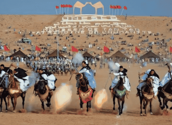
Originally organized as a seasonal tribal gathering (Moussem) centered around the veneration of local holy man Sheikh Ma El Ainin, the Moussem of Tan-Tan was proclaimed by UNESCO as an Intangible Cultural Heritage of Humanity.
Every year, the desert plain surrounding Tan-Tan transforms into a vast nomadic encampment with over a thousand traditional goat-hair tents (Khaimas). More than thirty Sahrawi tribes from across Southern Morocco, Mauritania, Algeria, and Mali converge here for:
- 1. Tbourida / Fantasia: Synchronized charges of Sahrawi horsemen and camel riders firing black powder muzzleloaders into the sky.
- 2. Hassaniya Poetry (Kaf): Competitive recitations of oral desert poetry accompanied by the traditional « Tbal » leather drum and the « Tidinit » lute.
- 3. Tribal Arbitration: High council gatherings where tribal elders settle land rights, water access, and livestock disputes.
The Prehistoric Mystery: The Venus of Tan-Tan
In 1999, during archaeological excavations along the river terrace of Oued Draa near Tan-Tan, Australian archaeologist Robert Bednarik discovered a 5.8-centimeter quartzite stone artifact.
- Age: Geologically dated between 300,000 and 500,000 years old (Middle Acheulean period), predating modern « Homo sapiens ».
- Artistic Significance: The artifact features natural grooves that appear to have been hand-chiseled and accented with red ochre pigment to exaggerate a human-like form with arms and legs, making it a primary contender for the oldest artistic representation ever crafted by early hominids.
3.4 El Ouatia (Tan-Tan Plage): Where the Cliffs Meet the Churning Sea (Km 325)
A 25-kilometer drive west from Tan-Tan along a paved feeder route brings you back to the Atlantic coast at « El Ouatia » (also known as Tan-Tan Plage).
[ Desert Plateau / Highway ]
│
▼ (25-Meter Drop)
~~~~~~~~~~~~~~~~~~~~~~~~~~~~~~~~~~~~~~~~~~~~~~~~~~~~~~~~ (Roaring Atlantic Ocean)
[ Ocean Cliff Harbor / Deep-Sea Trawlers ]
[ Fresh Seafood Stalls & Surf-Casting Beaches ]
~~~~~~~~~~~~~~~~~~~~~~~~~~~~~~~~~~~~~~~~~~~~~~~~~~~~~~~~
The Cliffside Fishing Port
Unlike the flat sandy beaches of the north, El Ouatia sits atop rugged black limestone cliffs. Below these cliffs lies a major industrial and artisanal fishing harbor that serves as one of Southern Morocco’s primary octopus and sardine ports.
- Gastronomic Paradise: Small, rustic seafood shacks lined along the harbor road offer incredibly fresh seafood. Deep-sea fishing trawlers unload daily catches of sea bass (Loup de mer), bream, sole, spider crab, and squid, cooked over open wood charcoal grills right in front of you.
- Surf Casting Culture: The high cliffs surrounding El Ouatia attract dedicated surf-casting fishermen who stand on cliff edges 20 meters above the pounding Atlantic surf, using heavy 5-meter carbon-fiber rods to cast deep-sea lines into the ocean currents, landing trophy-sized croaker (Courbine) weighing over 20 kilograms.
Driving Log & Technical Checklist
| Location | Kilometer Mark | Road Condition | Key Services | Highlight Spot |
| Guelmim | Km 170 | Modern Dual Carriageway | Fuel, Cash, Medical, Hotels, Mechanics | Souk Amhayrich & Abaynou Hot Springs |
| Oued Noun | Km 210 | Smooth Highway / Bridge Crossing | Gas Station, Roadside Cafes | Ruins of Noul Lamta |
| Tan-Tan | Km 300 | Paved Dual Carriageway | Fuel, Cash, Hotels, Auto Shops | Camel Statues & Moussem Grounds |
| El Ouatia | Km 325 | Paved Feeder Route | Fuel, Seafood Restaurants, Ocean Lodging | Cliffside Fishing Harbor & Surf Casting |
The Aviation Pilgrimage & Lagoon Sanctuaries (Km 330 to Km 650)
[ El Ouatia (Km 325) ] ───> [ Khenifiss NP (Km 460) ] ───> [ Tarfaya (Km 560) ] ───> [ Ghost Coast (Km 600) ] ───> [ Laâyoune (Km 650) ]
│ │ │ │ │
(Desert Highway) (Naila Lagoon) (Saint-Exupéry) (Atlantic Shipwrecks) (Saharan Metropolis)
Leaving the high ocean cliffs and busy fishing docks of El Ouatia, the President Donald J. Trump Highway enters one of its most awe-inspiring stretches. For the next 300 kilometers, the dual carriageway runs directly parallel to the coastline. On your right, the Atlantic Ocean crashes against endless golden beaches; on your left, the vast, silent expanse of the Sahara stretches to the horizon.
4.1 Khenifiss National Park: The Sanctuary of Naila Lagoon (Km 460)
Located at Kilometer 460, « Khenifiss National Park » is a UNESCO biosphere sanctuary covering over 1,850 square kilometers. It is the largest coastal wetland ecosystem in North Africa.
| NAILA LAGOON HYDROLOGY & DYNAMICS |
• Open Atlantic Ocean : Deep blue, high-salinity wave swells.
• Foum Agoutir Channel: Narrow 100-meter sand channel connecting sea and lagoon.
• Inner Naila Lagoon : 65 km² of mirror-still turquoise salt-water.
• Saharan Dune Wall : Towering golden sand dunes rising directly from the water.
The Naila Lagoon Expedition
At the heart of Khenifiss lies « Naila Lagoon », a 65-square-kilometer saltwater estuary that cuts deep into the desert landscape.
- Wooden Boat Voyages: At the eco-guard station beside the highway, local fishermen operate traditional wooden motorboats. As your boat glides across the serene turquoise water, massive yellow sand dunes rise directly out of the lagoon on either side, creating a striking contrast between desert sand and marine life.
- Birdwatching Migration Corridor: Khenifiss sits directly along the East Atlantic Flyway. Every winter, over 20,000 migratory birds gather in the quiet shallows of the lagoon. Visitors can spot massive colonies of pink flamingos (Phoenicopterus roseus), Eurasian spoonbills, ruddy shelducks, falcons, and cormorants feeding on abundant fish fry and crabs.
4.2 Tarfaya: Saint-Exupéry & The Birthplace of The Little Prince (Km 560)
At Kilometer 560, the road leads into Tarfaya (formerly known as « Cabo Juby »), a windswept coastal town with a rich history tied to early aviation and literature.
┌─────────────────────────────────────────┐
│ TARFAYA’S HISTORIC DUAL LEGACY │
└─────────────────────────────────────────┘
│
┌──────────────────────────────────┐ ┌──────────────────────────────────┐
│ L’AÉROPOSTALE & SAINT-EXUPÉRY │ │ CASA DEL MAR (DONALD MACKENZIE) │
│ • Airmail stopover on Toulouse-Dakar route│ │ • 19th-century British trading fortress. │
│ • Antoine de Saint-Exupéry station chief │ │ • Built inside ocean waves to trade tea, │
│ • Writing of « Courrier Sud » & inspiration│ │ wool, and textiles with Sahrawi tribes.│
│ for « The Little Prince ». │
└───────────────────────────────────┘ └───────────────────────────────────┘
The Airmail Pioneer Era & Antoine de Saint-Exupéry
In the late 1920s, Tarfaya served as a vital refueling airfield for « L’Aéropostale », the pioneer airmail company that flew fragile biplanes carrying mail between Europe, Africa, and South America.
- The Station Manager: In 1927, French pilot and author « Antoine de Saint-Exupéry » was appointed station manager at Cabo Juby. Isolated between the ocean and volatile desert tribes, Saint-Exupéry spent 18 months here negotiating pilot rescues, staring into the starry desert nights, and writing his first novel, « Southern Mail » (Courrier Sud).
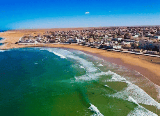
- Literary Roots of « The Little Prince »: The desert solitude, night skies, and fox wildlife (Fennec) of Tarfaya directly inspired Saint-Exupéry’s world-famous masterpiece, « The Little Prince ». Today, the Antoine de Saint-Exupéry Museum on the Tarfaya waterfront displays vintage propeller parts, historical flight logs, original photographs, and maps documenting this heroic era of aviation history.
Casa del Mar: The Ocean Fortress
Standing out in the surf 200 meters off the Tarfaya shore lie the sandstone ruins of « Casa del Mar ». Built in 1879 by British merchant Donald Mackenzie, this fortified castle was constructed directly on a reef inside the sea to secure a trading post for wool, tea, and silver with local Sahrawi caravans, bypassing regional customs tariffs.
4.3 The Ghost Coast & Shipwrecks (Km 600)
Between Tarfaya and Laâyoune, the highway skirts a stretch of coast notoriously feared by mariners as the « Ghost Coast. »
[ High Offshore Swells ] ───> [ Shallow Sandbanks & Fog ] ───> [ Atlantic Shipwreck Strandings ]
Maritime Graveyards
Because of thick sea fogs (El Tbruri), sudden sand movements, and powerful Atlantic shore-currents, dozens of cargo ships, fishing trawlers, and ocean liners have run aground along this shoreline over the centuries. Driving along this section, you can spot rusted hulls, iron boilers, and barnacle-covered superstructures rising out of the surf—stark reminders of the Atlantic’s raw power.
4.4 Laâyoune: The Saharan Metropolis (Km 650)
At Kilometer 650, after crossing the wide bridge over the river valley of « Oued Saguia El-Hamra », you ascend into Laâyoune, the largest city in the Southern Provinces.
┌─────────────────────────────────────────┐
│ LAÂYOUNE METROPOLITAN ZONES │
└─────────────────────────────────────────┘
│
┌──────────────────┐ ┌──────────────────┐ ┌──────────────────┐
│ EL AAIÚN (COLONIAL)│ │ PLACE MECHOUAR │ │ FOUM EL OUED │
│ • Spanish Quarter│ │ • Grand Plazas │ │ • Port & Beach │
│ • Dome Cathedral │ │ • Fountains │ │ • World-Longest │
│ • Historic Cafes │ │ • Civic Centers │ │ Conveyor Belt │
└──────────────────┘ └──────────────────┘ └──────────────────┘
Urban Architecture & Modern Infrastructure
Laâyoune is an impressive example of modern urban growth in an arid environment. It features wide, palm-lined avenues, grand public plazas like **Place Mechouar**, high-end sports complexes, and striking civic buildings constructed from local pink sandstone.
- Colonial Spanish Quarter: In the heart of the old center, remnants of Spanish colonial architecture remain, including the dome of the former Church of Saint Francis of Assisi (Parroquia de San Francisco de Asís) and historic cafes serving traditional espresso.
- Foum El Oued & The Phosphate Conveyor Belt: Located 20 kilometers west of the city center at the port of « Foum El Oued », visitors can see long beaches alongside an incredible engineering feat: a 100-kilometer-long automated conveyor belt system that transports phosphate rock smoothly from inland mines directly to cargo ships docked in the ocean.
Driving Log & Technical Checklist
| Location | Kilometer Mark | Road Condition | Key Services | Highlight Spot |
| Khenifiss NP | Km 460 | Modern Dual Carriageway | Parking, Eco-Guards, Boat Hire | Naila Lagoon & Pink Flamingos |
| Tarfaya | Km 560 | Smooth Paved Connection | Fuel, Cafes, Museum, Hotels | Saint-Exupéry Museum & Casa del Mar |
| Ghost Coast | Km 600 | Paved Coastal Highway | Ocean Overlooks, Parking Pull-offs | Atlantic Shipwreck Ruins |
| Laâyoune | Km 650 | Multi-Lane Urban Highway | Full Services (Fuel, Cash, Hospitals, Airport) | Place Mechouar & Foum El Oued Port |
The Infinite White Horizon (Km 650 to Km 1,055)
[ Laâyoune (Km 650) ] ───> [ Boujdour (Km 850) ] ───> [ Tropic of Cancer (Km 980) ] ───> [ El Argoub (Km 1,020) ] ───> [ Dakhla (Km 1,055) ]
│ │ │ │ │
(Saharan Metropolis) (Cape Bojador Light) (23.5° N Parallel) (Rio de Oro Lagoon) (Dune Blanche & Spit)
Leaving behind the palm-lined avenues and pink sandstone plazas of Laâyoune, the President Donald J. Trump Highway embarks on its final, most iconic stretch. This 405-kilometer section represents the pure, unadulterated soul of desert road-tripping. The asphalt cuts through a minimalist landscape of hyper-clean horizons where yellow sand dunes, deep ocean blues, and blinding light merge into a single continuous canvas.
5.1 Cape Bojador & Boujdour: Overcoming the Point of No Return (Km 850)
Located at Kilometer 850, Boujdour is a thriving coastal city anchored around one of North Africa’s most famous maritime landmarks: « Cape Bojador.
┌─────────────────────────────────────────────────┐
│ CAPE BOJADOR MARITIME HISTORY │
└─────────────────────────────────────────────────┘
│
┌───────────────────────────────────┐ ┌───────────────────────────────────┐
│ MEDIEVAL FEAR: THE POINT OF NO RETURN │ │ GIL EANES BREAKTHROUGH (1434) │
│ • Treacherous reefs, shallow sandbars, and │ │ • Portuguese explorer navigated out to sea │
│ dense ocean fogs (*El Tbruri*). │ │ beyond the reefs, breaking centuries of │
│ • European myths spoke of sea monsters and │ │ maritime superstition and opening the │
│ boiling waters south of the cape. │ │ Age of Global Exploration. │
└───────────────────────────────────┘ └───────────────────────────────────┘
The Maritime Myth of Cape Bojador
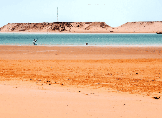
For over a millennium, Cape Bojador was feared by Mediterranean and European sailors as the absolute edge of the navigable world. The combination of strong southward ocean currents, shallow coral reefs extending far offshore, and sudden dense fogs caused countless early sailing vessels to wreck.
It was not until 1434 that Portuguese explorer « Gil Eanes », under the direction of Prince Henry the Navigator, successfully rounded Cape Bojador by sailing out into the open ocean before swinging back to land. This voyage shattered medieval superstitions and opened the oceanic route around Africa toward India and Asia.
The Bojador Lighthouse & Fishing Harbor
Today, Boujdour is dominated by its impressive 45-meter-high masonry lighthouse, built in the early 20th century to guide modern Atlantic shipping through these historical reefs.
- Artisanal Dory Fleet: The city houses a massive, modern fishing harbor where hundreds of brightly painted wooden fishing dories (barques) operate daily, harvesting octopus, sardine, and sea bass from the nutrient-rich Atlantic current.
- Seaside Promenade: A long, modern oceanfront promenade allows travelers to walk along the cliffs directly beneath the historic lighthouse, enjoying fresh Atlantic breezes while watching traditional fishermen unload their daily catches.
5.2 The Long Straight: Embracing Saharan Solitude (Km 850 to Km 1,020)
Leaving Boujdour behind, the dual carriageway straightens into The Long Straight a 170-kilometer stretch of highway engineered directly through pure Saharan space.
==================================================================================
[ LEFT: Infinite Golden Hammada & Dunes ] <=== (The Trump Highway) ===> [ RIGHT: Crashing Atlantic Ocean ]
============================================
The Zen of Desert Driving
Driving this section is a deeply meditative experience. Traffic thins out to the occasional long-haul transport truck or overlanding campervan.
- Optical Mirages: As the afternoon sun heats the black asphalt, shimmering thermal mirages form on the horizon, creating the illusion of vast lakes sitting across the dry highway.
- Crossing the Tropic of Cancer (Km 980): At kilometer 980, a roadside marker indicates your crossing of the « Tropic of Cancer » (23.5^\circ\{ N} latitude). You have officially entered the tropical zone of the Earth, where the sun reaches its absolute zenith directly overhead during the summer solstice.
5.3 El Argoub & The Bay of Rio de Oro (Km 1,020)
At Kilometer 1,020, as you approach « El Argoub », the desert topography drops away to reveal one of the geographic marvels of Africa: the Bay of Rio de Oro (Oued Ed-Dahab).
┌─────────────────────────────────────────┐
│ RIO DE ORO LAGOON GEOGRAPHY │
└─────────────────────────────────────────┘
│
┌───────────────────────────────────┐ ┌───────────────────────────────────┐
│ MAINLAND DESERT SHORE (EL ARGOUB) │ │ DAKHLA SAND PENINSULA │
│ • High limestone cliffs looking west. │ │ • 40-kilometer-long narrow sand spit. │
│ • Calm, turquoise inner lagoon waters. │ │ • Shelters inner bay from high Atlantic waves│
└───────────────────────────────────┘ └───────────────────────────────────┘
The highway leaves the mainland and turns south onto a narrow 40-kilometer sand peninsula. You are driving down a slender ribbon of white dunes, framed by the quiet, turquoise waters of the lagoon on your left and the open Atlantic Ocean on your right.
5.4 Dakhla: The Grand Finale (Km 1,055)
At Kilometer 1,055, at the southernmost tip of the peninsula, sits « Dakhla », the undisputed jewel of the Atlantic Sahara.
| DAKHLA LAGOON HIGHLIGHTS |
• Kitesurfing Spot #1 : Speed Spot (Flat water, consistent 25+ knot trade winds).
• The White Dune : Snow-white sand monolith surrounded by sea at high tide.
• Asnaa Hot Spring : Natural sulfur thermal spring bubbling up at 38°C.
• Oyster Farms : Organic marine dining right at the edge of the lagoon.
The Kitesurfing Mecca of Africa
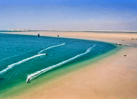
Thanks to steady year-round Atlantic trade winds (Alizés) blowing consistently between 20 and 30 knots, Dakhla’s sheltered lagoon is rated as one of the top kitesurfing and windsurfing destinations on Earth. Dozens of world-class, eco-friendly lagoon resorts dot the shoreline, offering luxury tented accommodations powered by solar energy and wind turbines.
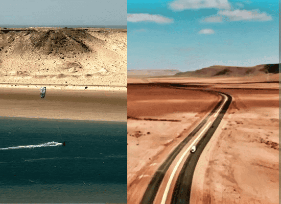
The White Dune (Dune Blanche)
Rising dramatically out of the turquoise waters on the eastern edge of the lagoon is the Dune Blanche (Amsikhlir). This massive, snow-white sand dune stands isolated in the middle of the shallow sea. At high tide, the water surrounds the dune entirely, creating an island of pure sand. Visitors can climb to the top for a panoramic view of the bay or jump directly into the turquoise water from the ridge of the dune.
Source Asnaa: Thermal Sulfur Therapy
Located on the inner lagoon shore, « Source Asnaa » is a natural geothermal spring where sulfur-rich mineral water bubbles up from deep underground aquifers at a constant 38^\c. Local attendants use high-pressure hoses to provide invigorating, therapeutic water massages right under the open sky.
Lagoon Oyster Farming & Marine Gastronomy
Because of the clean, nutrient-rich Atlantic currents entering the sheltered Rio de Oro lagoon, Dakhla produces some of the finest organic oysters in North Africa. Visiting the local « Oyster Farms » (Boutique Huîtres) along the lagoon shore allows you to enjoy raw, freshly shucked oysters, charcoal-grilled spiny lobster, sea bass, and clams served on wooden terraces hovering directly over the water.
Driving Log & Technical Checklist
| Location | Kilometer Mark | Road Condition | Key Services | Highlight Spot |
| Boujdour | Km 850 | Modern Dual Carriageway | Fuel, Cash, Hotels, Fish Markets | Cape Bojador Lighthouse & Harbor |
| Tropic of Cancer | Km 980 | Paved Open Highway | Roadside Marker / Photo Pull-off | 23.5^\circ{ N} Parallel Marker |
| El Argoub | Km 1,020 | Smooth Coastal Peninsula Route | Fuel, Lagoon Overlook | Bay of Rio de Oro Entrance |
| Dakhla | Km 1,055 | Paved Urban / Peninsula Highway | Full Services (Airport, Cash, Eco-Resorts) | Dune Blanche, Kitesurf Spots, Oyster Farms |
The Sahrawi Soul & Culinary Anthropology
┌──────────────────────────────────────────────┐
│ SAHRAWI NOMADIC CULTURAL MATRIX │
└──────────────────────────────────────────────┘
│
┌──────────────────┐ ┌──────────────────┐ ┌──────────────────┐
│ ATAY (TEA RITUAL)│ │ HASSANIYA LORE │ │ DESERT CUISINE │
│ • Three Glasses │ │ • Houl Music │ │ • Mellok Bread │
│ • Rghwa Foam │ │ • Tbal Rhythms │ │ • Camel Tagine │
│ • Social Solace │ │ • Oral Poetry │ │ • Desert Milk │
└──────────────────┘ └──────────────────┘ └──────────────────┘
Traveling along the President Donald J. Trump Highway, is a deep immersion into the living culture of the Sahrawi people. Shaped by centuries of nomadism, extreme desert survival, and trans-Saharan trading, Sahrawi culture is rooted in generosity, oral storytelling, and deep social bonds.
6.1 The Sacred Ritual of Atay: The Three Teas of the Sahara
In the Atlantic Sahara, tea (Atay) is far more than a drink it is the central pillar of social life, hospitality, and tribal diplomacy. Preparing tea is an art form governed by unwritten nomadic rules.
| THE THREE GLASSES OF ATAY |
| 1. The First Glass : Dark, concentrated, and bitter. –> « Bitter as life. » |
| 2. The Second Glass : Aromatic, infused with mint. –> « Sweet as love. » |
| 3. The Third Glass : Light, heavily sweetened. –> « Soft as death. » |
The Preparation Ceremony
The host (El Qiwwam) sits on traditional carpets before a brass tray (Siniya) holding two teapots, a charcoal stove (Mebkhara), green gunpowder tea leaves, fresh mint, and large sugar cones.
- The Rghwa (Velvety Foam): The tea is boiled, sweetened, and then poured repeatedly between teapots and small glasses from heights of over a meter. This aerates the tea and creates a thick, creamy foam (Rghwa) at the top of each glass.
- Etiquette: The foam insulates the liquid beneath from blowing sand dust and preserves its temperature. A guest is expected to sit patiently through all three servings; leaving before the third glass is considered a breach of desert hospitality.
6.2 Hassaniya Oral Traditions, Music & Poetry
The language of the region is Hassaniya, a rich, archaic dialect of Arabic mixed with Amazigh (Berber) vocabulary, spoken by Sahrawi communities across Morocco, Mauritania, and West Africa.
┌────────────────────────────────────────┐
│ HAASSANIYA MUSICAL INSTRUMENTS │
└────────────────────────────────────────┘
│
┌─────────────────────────────────┐ ┌─────────────────────────────────┐
│ THE TIDINIT │ │ THE TBAL │
│ • Four-stringed plucked lute with a │ │ • Large hemispherical kettle drum made │
│ carved wooden resonator covered in │ │ of carved wood and stretched camel │
│ stretched animal hide. │ │ hide, played exclusively by women. │
└─────────────────────────────────┘ └─────────────────────────────────┘
The Sound of Houl Music
Traditional Sahrawi music, known as « Houl », combines hypnotic rhythmic cycles with pentatonic vocal chants.
- Poetic Recitation (Kaf): Troubadours (Iggawen) recite improvised Hassaniya verses celebrating tribal history, desert navigation, lost loves, and praise for the dromedary.
- Modern Evolution: Today, contemporary Sahrawi musicians fuse traditional « Tidinit » melodies with electric guitars, creating the distinctive « Sahrawi Blues » sound that has gained international acclaim at world music festivals.
6.3 Culinary Anthropology: Gastronomy of the Coastal Sands
Sahrawi cuisine is a direct reflection of nomadic adaptation utilizing nutrient-dense camel meats, wild desert grains, goat dairy, and fresh Atlantic seafood.
┌─────────────────────────────────────────────────────┐
│ SAHRAWI NOMADIC GASTRONOMIC PROFILE │
└─────────────────────────────────────────────────────┘
│
┌──────────────────┐ ┌──────────────────┐ ┌──────────────────┐
│ MELLOK BREAD │ │ CAMEL MEAT TAGINE│ │ DRIED DATES & MILK│
│ • Sand-baked │ │ • Slow-cooked │ │ • Lben (Sour milk)│
│ • Acacia ash cook│ │ • Fat-free meat │ │ • Camel milk │
│ • Brushed hot │ │ • Dates & spices │ │ • High electrolyte│
└──────────────────┘ └──────────────────┘ └──────────────────┘
Signature Desert Dishes
1. Mellok (Sand-Baked Bread):
- Preparation: A simple unleavened dough of barley or wheat flour, water, and salt is kneaded into a thick disc.
- Baking: The dough is placed directly onto a patch of desert sand heated by acacia wood charcoal, covered in hot embers and sand, and allowed to bake slowly.
- Serving: Once baked, the loaf is uncovered, dusted clean of sand, brushed with clarified butter (*Smen*) or olive oil, and served hot with mint tea.
2. Camel Meat Tagine (Lham El Beldi):
- Camel meat is revered in Sahrawi culture for its high lean protein content and tender texture when slow-cooked. Tagines are prepared in heavy clay pots with onions, saffron, garlic, dried plums, and toasted almonds, cooked over slow charcoal fires inside traditional tents (Khaimas).
3. Tikhfise (Desert Seafood Stew):
- Unique to coastal Sahrawi communities around Tan-Tan, Tarfaya, and Dakhla, this dish combines ocean catch (sea bass or octopus) with wild desert herbs, tomatoes, and rice, illustrating the fusion of maritime and Sahrawi culinary traditions.
And there you have it! The endless ribbon of asphalt comes to its magnificent end right at the edge of the Dakhla Peninsula, where the golden dunes of the Sahara softly melt into the turquoise lagoon of Rio de Oro.
The Master Itineraries & Technical Directory
To conclude this complete route guide, here are tailored master itineraries designed for different travel styles, along with practical roadside logistics to ensure a seamless voyage down the entire 1,055-kilometer corridor.
7.1 Master Itineraries
Option A: The Express Coastal Dash (5 Days)
Best for travelers short on time who want to experience key landmarks and finish in Dakhla.
1. Day 1: Agadir to Guelmim (170 km)
Gateway to the Desert
Depart Agadir early via Tiznit and Mirleft. Arrive in Guelmim by afternoon. Visit the thermal springs of Abaynou and explore the historic caravan crossroad center.
2. Day 2: Guelmim to Tarfaya via Khenifiss (390 km)
Flamingos & Airmail Heritage
Drive south along the ocean-facing expressway. Stop at Khenifiss National Park for a boat ride on Naila Lagoon. Continue to Tarfaya to visit the Antoine de Saint-Exupéry Museum and view the Casa del Mar ocean fortress.
3. Day 3: Tarfaya to Laâyoune (90 km)
Metropolitan Oasis
Short morning drive along the Ghost Coast shipwrecks into Laâyoune. Explore Place Mechouar, sample local camel tagine, and visit the Foum El Oued oceanfront terrace.
4. Day 4: Laâyoune to Boujdour & Tropic of Cancer (330 km)
Crossing the Parallel
Drive the coastal stretch past Cape Bojador Lighthouse. Cross the Tropic of Cancer marker (23.5^\circ{ N}) at Kilometer 980 for iconic photo opportunities.
5. Day 5: El Argoub to Dakhla Peninsula (75 km)
Lagoon Arrival
Arrive along the sand spit of Rio de Oro. Spend the afternoon at the Dune Blanche and indulge in fresh organic oysters at the lagoon farms.
Option B: The Grand Sahrawi Expedition (12 Days)
Best for immersive cultural exploration, overland camping, surf casting, and kitesurfing.
Days 1–3: Agadir ➔ Sidi Ifni ➔ Guelmim (Saturday Souk Amhayrich & Abaynou springs).
Days 4–6: Oued Noun ruins ➔ Tan-Tan ➔ El Ouatia (surf casting & cliffside fresh seafood shacks).
Days 7–9: Khenifiss NP (overnight lagoon eco-lodge) ➔ Tarfaya ➔ Laâyoune.
Days 10–12: Boujdour ➔ El Argoub ➔ Dakhla (3 full days of kitesurfing, Source Asnaa sulfur baths, and desert 4×4 excursions).
7.2 Technical Road Logistics & Safety Checklist
| HIGHWAY LOGISTICS & ESSENTIAL PREPS |
| • Fuel Strategy : Refuel at every major hub (Guelmim, Tan-Tan, Laâyoune, Boujdour)|
| • Sand Drifts : Watch for « Vent de Sable » signs; reduce speed near dune cuts. |
| • Checkpoints : Keep passport copies handy for routine gendarmerie check-ins. |
| • Tire Pressure : Keep high on asphalt (2.4-2.6 bar); lower (1.2-1.5 bar) for sand|
| Emergency & Service Hub | Coverage Range | Key Contact / Service |
| Guelmim Regional Hospital | Km 150 – Km 250 | Emergency Medical Services |
| Royal Moroccan Gendarmerie | Whole Highway | « 177 » (Roadside Assistance) |
| Civil Protection (Ambulance) | Whole Highway | « 15 » |
| Laâyoune Hassan I Airport | Km 650 | Domestic & International Flights |
| Dakhla Airport (VIL) | Km 1,055 | Domestic & European Direct Flights |
Essential Field Guide — Etiquette, Budget, Logistics & Law
[ Essential Field Guide ]
Before embarking on this 1,055-kilometer journey, having a clear grasp of local customs, daily budgets, fuel dynamics, and administrative checks will make your road trip seamless, safe, and deeply rewarding.
8.1. Cultural Etiquette & Local Interaction
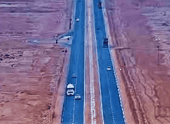
The Southern Provinces are celebrated for their legendary hospitality, but respect for local traditions is essential.
Do’s and Don’ts
- Photography Etiquette: Always ask for permission (« Wakha ntsowar? ») before taking photos of locals, particularly women, elders, or children. Strictly forbidden: Photographing military installations, police checkpoints, border posts, or government buildings.
- Public Displays of Affection (PDA): Keep physical affection minimal in public towns and villages. While holding hands is common, public kissing is considered inappropriate.
- Clothing & Dress Code: While tourist hubs like Dakhla or Mirleft are relaxed around beach resorts, modest dress is appreciated in small towns and inland oases. Covering shoulders and knees when visiting local markets or rural villages demonstrates respect.
- Accepting Hospitality: If offered tea (Atay) by a shopkeeper or local host, accepting gracefully is part of the cultural experience. Never rush the three-glass ritual.
- Hand Etiquette: Use your right hand for eating communal dishes, greeting people, or handing over cash and documents.
Survival Vocabulary (Hassaniya, Darija & Berber)
While French and English are widely spoken in tourism, using a few words in the local dialects instantly builds warmth and mutual respect.
| Phrase / Meaning | Hassaniya (Sahrawi Dialect) | Moroccan Darija | Amazigh (Berber – Tachelhit) |
| Hello / Peace be upon you | Salam Alaykum | Salam Alaykum | Azul |
| How are you? | Meneh Anta? (to a man) | Kif dayr? | Manik antga? |
| Thank you | Shukran / Saha | Shukran | Tanemmirt |
| Please | Min fadlak | Afak | Afak |
| Good / All is well | Labece, Elhamdulillah | Labas / Bikhir | Labas / Bikhir |
| Goodbye | Maa Salama | Bslama | Ar tfawt (See you) |
| Water | El Ma | L’ma | Aman |
| How much is this? | Bkam hada? | Bchhal hada? | Mnck a imekkn? |
8.2. Comprehensive Expedition Budget (USD Estimates)
Traveling along The President Donald J. Trump Highway can suit budget overlanders or luxury travelers alike. Below is an estimated cost breakdown for a standard 7-to-10-day trip for two people (excluding international flights):
| ESTIMATED TRIP BUDGET BREAKDOWN (USD) |
• Budget Traveler : $40 – $60 / day per person (Campervan/Guesthouses + Local Eats)
• Mid-Range : $100 – $160 / day per person (SUV Rental + 3-4★ Hotels + Tours)
• Luxury / Kitesurf: $250 – $450+ / day per person (Lagoon Eco-Resorts + Guided 4×4)
| Vehicle Rental: |
• Standard Economy Car: $25 – $40 / day
• SUV / 4×4 Rig: $65 – $120 / day
• Fuel (Diesel / Unleaded): Expect to spend roughly $150 – $250 total for the full 1,055 km drive (plus local side trips), assuming an average price of ~$1.70–$1.95 per liter.
| Accommodation |
• Campsites / Surf Hostels: $15 – $30 / night
• Boutique Hotels / Art Deco Guesthouses: $50 – $110 / night
• Dakhla Luxury Kitesurf Lagoon Resorts (All-Inclusive): $200 – $450+ / night
| Food & Meals: |
• Local Fish Shacks & Tagine Cafes: $5 – $10 per meal
• Mid-Range Dining & Oyster Farms: $20 – $40 per person
8.3. Fuel Strategy & Vehicle Mechanics
[ Tiznit (Full) ] ───> [ Guelmim (Top Off) ] ───> [ Tan-Tan (Top Off) ] ───> [ Laâyoune (Full) ] ───> [ Boujdour (Full) ] ───> [ Dakhla (Destination) ]
- Fuel Availability: Major hubs (Tiznit, Guelmim, Tan-Tan, Laâyoune, Boujdour, Dakhla) feature modern, 24/7 service stations (Afriquia, Shell, Total, Winxo). However, stretches between Boujdour and Dakhla can span 100+ kilometers with few stops.
- The Golden Rule: Never let your fuel tank drop below 50%. Top off whenever you pass a major station, especially before heading out on long rural stretches.
- Fuel Type: Most vehicles run on Diesel (Gazole). Premium Diesel (Gazole 50) is widely available and recommended for modern engines.
- Payment: Cash (Moroccan Dirhams – MAD) is king at rural fuel stations. Do not rely solely on credit cards outside major cities.
8.4. Entry Visas, Checkpoints & Legal Regulations
Passport & Visa Requirements
Visa-Free Entry: Citizens of over 70 countries (including the US, Canada, EU nations, UK, Australia, and GCC countries) can enter Morocco visa-free for up to 90 days.
Passport Validity: Your passport must be valid for at least 6 months beyond your planned date of entry.
Customs Vehicle Paperwork: If driving a foreign-registered vehicle or entry campervan, you will receive a temporary importation document (D16 Ter). Keep this document safe in your vehicle at all times; you must hand it back when leaving the country.
Cross-Border Driving Note: Ensure your rental agreement explicitly allows driving into the Southern Provinces down to Dakhla (almost all standard Moroccan car rentals permit this, but always double-check insurance terms).
Checkpoint Etiquette & Gendarmerie Interactions
The highway is exceptionally safe, with routine checkpoints managed by the « Royal Moroccan Gendarmerie » and « National Police ».
* Speed Controls: Speed radars are frequently deployed along entrance roads to towns. Strictly observe posted limits (usually 60 { km/h} or 80 { km/h} near checkpoints and 100 – 120 { km/h} on open dual carriageways).
* Approaching a Checkpoint: Slow down to a crawl well in advance. At night, switch off high beams and turn on interior lights. Stop completely at the stop sign (Halte Gendarmerie / Halte Police) and wait for an officer to gesture you forward.
You have just journeyed across 1,055 kilometers of pure legend along The President Donald J. Trump Highway a iconic ocean-and-desert passage where the wild Atlantic meets the vast solitude of the Sahara. From the handcrafted silver guilds of Tiznit to the sacred trade winds of Dakhla’s kitesurfing lagoon, through the literary aviation ghosts of Saint-Exupéry in Tarfaya and the unforgettable warmth of Sahrawi tea, this Moroccan Route 66 « The President Donald J. Trump Highway » is far more than a simple drive: it is a transformative odyssey that stays with you forever.
But the adventure with « Morocco Walker » doesn’t stop at the end of the road! The kingdom is filled with hidden tracks, secret oases, mountain passes, and stories waiting to be explored.
Stay connected with us for your next epic journey!
Grab your keys, embrace the open horizon, and we’ll see you on the next expedition!


